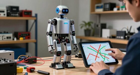
When choosing between LiDAR and cameras for navigation, consider their strengths and weaknesses. LiDAR offers high accuracy, long-range detection, and resilience in harsh environments but has higher costs and requires frequent calibration. Cameras are cheaper, lightweight, and perform well in good lighting but struggle in low-light or bad weather. Understanding how environmental factors, system integration, and maintenance affect each helps you pick the right sensor—keep exploring to get a clearer picture of their true trade-offs.
Key Takeaways
- LiDAR offers superior accuracy and range, especially in complex or low-light environments, but requires more calibration and maintenance.
- Cameras are cost-effective and easier to upgrade but are sensitive to lighting conditions and weather, impacting reliability.
- LiDAR’s durability makes it suitable for harsh environments, whereas cameras are more vulnerable to dust, rain, and vibration.
- Data fusion from both sensors enhances perception but increases system complexity, processing demands, and integration challenges.
- Long-term stability favors LiDAR in demanding applications, while cameras excel in controlled settings with lower operational costs.

TOFFUTURE XT-M60 Flash Lidar 15m Detect Range 120°x45°FOV Pure Solid Lidar, Advanced High Sensitivity & Aimbient Light Surpression ToF Technology Lidar Sensor for Autonomous Vehicles Robotics IOT
✅ Eliminate Dead Zones: XT-M60 flash LiDART can detect obstacles within 15 meters (at 50% reflectivity) using advanced…
As an affiliate, we earn on qualifying purchases.
As an affiliate, we earn on qualifying purchases.
How Do LiDAR and Cameras Capture Their Environment?

LiDAR and cameras capture their environment in fundamentally different ways. LiDAR uses laser pulses to measure distances, creating precise 3D maps, but it requires regular sensor calibration to maintain accuracy. Environmental interference, like fog, rain, or dust, can disrupt laser signals, reducing effectiveness. Additionally, the cost and complexity of LiDAR systems can be a consideration for certain applications. Cameras, on the other hand, record visual information in the form of images or videos, relying on light. They are less affected by some environmental factors but can struggle in low-light or glare conditions. Unlike LiDAR, cameras don’t need extensive calibration for basic operation, but their performance depends heavily on ambient lighting and clarity. Both sensors face challenges from environmental interference, but their methods of capturing data determine how well they function in different conditions. Understanding sensor calibration and maintenance needs is essential for optimizing system performance in various environments.

Camera based Navigation by Mobile Robots: Local Visual Feature based Localisation and Mapping
As an affiliate, we earn on qualifying purchases.
As an affiliate, we earn on qualifying purchases.
Which Sensor Is More Accurate and Has a Greater Range?

When comparing their accuracy and range, LiDAR generally outperforms cameras due to its ability to provide precise 3D measurements over longer distances. LiDAR sensors deliver highly accurate spatial data, making them ideal for detailed mapping and obstacle detection. While cameras can capture fine visual details, their accuracy diminishes with distance, especially in low-light conditions. Additionally, LiDAR’s sensor durability allows it to withstand harsh environments, maintaining consistent performance. Its sensor technology often enables it to operate reliably in various weather conditions, unlike cameras which are more affected by environmental factors. Furthermore, sensor calibration is a crucial aspect that can influence the overall accuracy of both systems, with LiDAR typically requiring less frequent adjustments. Proper sensor maintenance can also extend the lifespan and reliability of LiDAR units, ensuring optimal performance over time. Advances in manufacturing variability are improving LiDAR’s cost and consistency, making it more accessible for diverse applications. However, manufacturing variability can impact LiDAR’s cost and consistency, potentially affecting its long-term reliability. Cameras, on the other hand, are more susceptible to environmental factors like weather and lighting changes, which can compromise accuracy. Overall, LiDAR offers superior range and precision, but factors like durability and manufacturing variability influence its effectiveness for different applications. Understanding these differences is essential for selecting the appropriate sensor technology.

WayPonDEV FHL-LD19 360 Degree 2D Lidar Distance Sensor Kit, 10Hz Scan Rate and 12m Distance Lidar Scanner Module for Smart Obstacle/Robot/Maker Education Indoor/Outdoor
[High Accuracy] DTOF FHL-LD19 Kit, based on DTOF LD19, which has a sampling rate of 8000 times/s. In…
As an affiliate, we earn on qualifying purchases.
As an affiliate, we earn on qualifying purchases.
What Is the Cost of LiDAR vs. Camera Systems?

When comparing LiDAR and camera systems, you’ll want to contemplate more than just their prices. Think about the initial purchase costs, ongoing maintenance, and how easily you can upgrade or scale the system over time. These factors can considerably impact your overall investment and long-term value. For instance, understanding the technology differences between the systems can help you choose the most suitable option for your needs.
Initial Purchase Cost
While both LiDAR and camera systems have become essential for navigation, their initial purchase costs differ considerably. LiDAR sensors tend to be more expensive upfront due to advanced technology and higher hardware durability, which helps them withstand harsh environments. You’ll find that LiDAR systems often require less sensor calibration over time, saving you maintenance costs early on. Cameras, on the other hand, generally have a lower initial price but may need more frequent calibration and protective accessories to ensure consistent performance. The upfront investment for LiDAR can be several times higher than for cameras, but its robustness might justify the cost in demanding applications. Ultimately, your choice depends on balancing initial expenses against long-term reliability and performance needs.
Maintenance and Upkeep
LiDAR systems typically demand higher maintenance and upkeep costs compared to cameras due to their complex hardware and sensitivity to environmental conditions. You’ll need to regularly perform sensor calibration to ensure accuracy, especially after exposure to temperature fluctuations or physical shocks. The hardware durability of LiDAR units is also a concern; components can degrade faster when exposed to dust, moisture, or debris, leading to more frequent repairs or replacements. Cameras, by contrast, tend to require less intensive maintenance, mainly involving cleaning lenses and occasional software updates. Overall, the ongoing costs for LiDAR systems tend to be higher, driven by the need for precise calibration and the fragility of their hardware. This makes maintenance a key factor when evaluating the total ownership cost. Additionally, environmental factors such as dust and moisture can significantly impact LiDAR performance and longevity.
System Scalability and Upgrades
Upgrading and expanding sensor systems can markedly impact total costs, especially considering their inherent differences. LiDAR systems often require precise sensor calibration after upgrades to maintain accuracy, which adds to ongoing expenses. Additionally, hardware compatibility is critical; integrating new LiDAR units with existing systems can be complex and costly. Cameras, on the other hand, typically have easier scalability, as they rely on software updates and interchangeable modules. Expanding camera systems usually involves less downtime and fewer calibration challenges. However, high-resolution cameras may need more powerful processing units, increasing overall costs. When planning for system scalability and upgrades, consider both initial investment and long-term maintenance, recognizing that LiDAR’s specialized hardware and calibration needs can make upgrades more expensive compared to camera-based systems.

Livox High – Precision Tele – 15 LiDAR for Long – Range Surveying & Mapping The First 500m Range Automotive
Livox High – Precision TELE – 15 LiDAR for Long – Range Surveying & Mapping The First 500m…
As an affiliate, we earn on qualifying purchases.
As an affiliate, we earn on qualifying purchases.
How Do Lighting and Weather Impact LiDAR and Cameras?
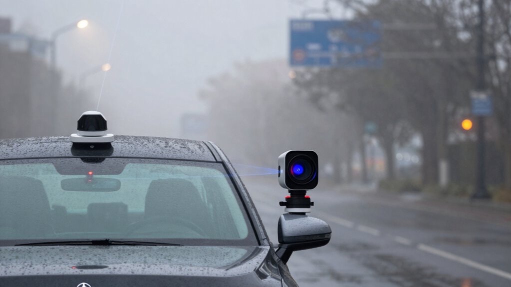
Lighting and weather conditions can profoundly affect how well LiDAR and cameras perform in navigation. Poor lighting, such as at night or in tunnels, hampers camera visibility, making object detection difficult. Weather challenges, like rain, fog, or snow, can scatter or absorb signals, reducing sensor accuracy. LiDAR systems often handle low-light better but struggle in heavy weather that causes signal interference. Cameras rely heavily on adequate lighting, while LiDAR can still function in darkness but may be affected by adverse weather. Sensor performance varies depending on environmental conditions, so understanding these impacts helps you choose the right sensor combination for varying environments. Additionally, advancements in sensor technology continue to improve resilience under challenging conditions. Moreover, ongoing research into sensor fusion techniques aims to combine data from multiple sensors to compensate for individual limitations.
What Are the Challenges in System Integration and Complexity?

Integrating LiDAR and camera systems presents significant challenges in combining data accurately. You’ll need to address sensor data fusion issues to guarantee seamless perception. Additionally, scaling these systems for larger applications can introduce complexity and performance hurdles. Properly managing sensor data fusion is crucial for achieving reliable and precise system integration. Moreover, differences in sensor resolution and data update rates can further complicate the fusion process, requiring sophisticated algorithms to synchronize and interpret the mixed data streams effectively. Ensuring robust data synchronization remains essential to mitigate errors caused by asynchronous sensor outputs. In complex environments, multi-sensor calibration becomes vital to maintain system accuracy and reliability. The integration process also demands effective error correction techniques to handle discrepancies and ensure data consistency across sensors.
Sensor Data Fusion Challenges
Combining data from LiDAR and cameras introduces significant system integration challenges because each sensor produces information in different formats, resolutions, and timeframes. To achieve accurate fusion, you must perform precise sensor calibration, ensuring both sensors align spatially and temporally. Data synchronization is vital; mismatched timestamps can lead to inconsistent or outdated information. These challenges include:
- Variability in data formats complicates processing pipelines.
- Differences in resolution require intelligent data filtering and scaling.
- Asynchronous data streams demand robust synchronization techniques.
Overcoming these hurdles involves sophisticated algorithms and careful hardware setup. Without proper calibration and synchronization, sensor fusion becomes unreliable, directly impacting the system’s perception accuracy and safety. Recognizing these challenges helps you design more resilient, integrated navigation solutions.
System Scalability Issues
As sensor systems grow more complex, scaling them to handle larger environments and higher data demands presents significant challenges. You face issues like sensor obsolescence, which can quickly render components outdated, and the difficulty of establishing clear upgrade pathways. Integration becomes complex as more sensors and processing units are added, increasing system fragility. Compatibility across diverse hardware and software adds to the challenge. To illustrate, consider this table:
| Challenge | Impact | Solution Approach |
|---|---|---|
| Sensor Obsolescence | Frequent replacements or upgrades | Modular design, standardized parts |
| Data Overload | Slower processing, bottlenecks | Efficient data management |
| Compatibility Issues | Integration delays | Open architecture |
| Upgrade Pathways | Limited options for system updates | Scalable, flexible frameworks |
| System Complexity | Increased failure points | Simplification, robust design |
Handling these issues requires careful planning to ensure system longevity and adaptability.
What Are the Data Processing and Computational Demands?

LiDAR systems generate vast amounts of high-resolution point cloud data that require significant processing power to interpret in real-time. This results in a high computational load and demands efficient data throughput to keep up with sensor output. Your vehicle’s onboard systems must handle complex algorithms for object detection, classification, and mapping without delay. Additionally, understanding cybersecurity vulnerabilities related to sensor data transmission is crucial for ensuring system integrity and safety. To manage this, you need: – Robust hardware capable of high data throughput and quick processing – Optimization of algorithms to reduce latency – Balancing data quality with processing speed to avoid bottlenecks. Moreover, sensor calibration is essential to maintain accurate data interpretation and system reliability. Proper calibration ensures the accuracy of data and consistent system performance over time. Implementing data management strategies can help optimize system efficiency and reduce processing burdens. Furthermore, employing scalable computing resources is vital to accommodate increasing data volumes and maintain system responsiveness. These factors influence overall system performance, affecting how quickly and accurately your vehicle can interpret its environment. The heavier the data processing demands, the more critical it is to have scalable, powerful computing resources.
How Scalable and Maintainable Are LiDAR and Camera Solutions?

Both LiDAR and camera systems vary considerably in how easily they can be scaled and maintained over time. LiDAR sensors often require regular sensor calibration to ensure accuracy, which can be time-consuming but manageable with proper procedures. Cameras, on the other hand, demand ongoing adjustments for lighting conditions and lens cleanliness. Software compatibility influences maintenance; updates can improve performance but may introduce compatibility issues. Scalability depends on hardware modularity and processing capacity. Here’s a quick comparison:
| Aspect | LiDAR | Camera | Challenges |
|---|---|---|---|
| Sensor calibration | Periodic, precise calibration needed | Less frequent, but light conditions matter | Maintaining calibration accuracy |
| Software updates | Usually hardware-specific | Widely compatible, easier updates | Compatibility with evolving software |
| Maintenance | Regular cleaning and calibration | Lens cleaning, lighting adjustments | Ensuring consistent data quality |
| Scalability | Modular, but costly expansion | Cost-effective, easy to add units | Managing data volume and processing |
| Calibration processes | Require detailed procedures for accuracy | Less intensive, but still necessary for optimal performance |
Which Sensor Is Best for Your Specific Application?

Choosing the right sensor depends heavily on your specific application requirements. If your project needs precise measurements, consider sensors that require rigorous calibration to maintain accuracy over time. For applications demanding consistent performance, sensor calibration is essential to ensure ongoing reliability. For real-time use in power-sensitive environments, low power consumption is vital; sensors with high energy demands may not be ideal. Think about the environment: outdoor applications benefit from LiDAR’s robustness, while cameras excel indoors with controlled lighting. Additionally, consider maintenance needs—sensors that need frequent calibration or complex setup can slow deployment. Incorporating outdoor sensor durability can further ensure reliable performance in harsh conditions. Furthermore, selecting sensors with long-term stability can reduce the need for frequent recalibration and maintenance.
How Do You Choose Between LiDAR and Cameras?

Selecting the right sensing technology hinges on understanding your project’s specific needs and constraints. If durability is a priority, consider how well each sensor withstands environmental factors; LiDAR units are generally more resilient against weather and physical impacts. However, calibration challenges can be significant—LiDAR sensors often require frequent recalibration to maintain accuracy, especially in dynamic environments. Cameras, on the other hand, are more sensitive to lighting conditions and may need constant adjustments for optimal performance. Think about your operating environment: Will the sensor face dust, rain, or vibration? If so, durability and ease of calibration become critical factors. Additionally, sensor calibration can be complex and time-consuming, influencing your choice depending on your capacity for maintenance. Considering environmental resilience is essential when choosing between sensors, as it directly impacts long-term performance. Ultimately, weighing sensor resilience against calibration challenges helps you select the technology that best aligns with your project’s robustness and reliability needs.
Frequently Asked Questions
How Do Lidar and Camera Sensors Perform in Extreme Environmental Conditions?
You’ll find that LiDAR sensors generally perform better in extreme environmental conditions because of their environmental resilience, handling fog, rain, and darkness more effectively. Camera sensors, however, can struggle with poor lighting and weather, affecting their sensor durability. In harsh environments, LiDAR’s robustness makes it a more reliable choice, while cameras may need additional protective measures to maintain performance and guarantee long-term durability.
What Are the Cybersecurity Risks Associated With Each Sensor Type?
Oh, the irony—you rely on your sensors for safety, yet they’re vulnerable to cybersecurity risks. Both LiDAR and camera systems face cybersecurity vulnerabilities, making them targets for sensor hacking. You might think they’re secure, but hackers can manipulate or disrupt data, risking safety and navigation. Vigilance is key; updating firmware and implementing robust cybersecurity measures help protect your systems from these sneaky threats.
How Do Sensor Sizes Impact Installation Flexibility and Vehicle Design?
Sensor size directly impacts your vehicle’s installation flexibility. Smaller sensors, like compact cameras, let you place them in tight spaces, enabling sleeker designs and easier integration into various vehicle models. Larger sensors, such as some LiDAR units, may require more space and complex mounting, limiting design options. So, choosing a sensor size aligns with your vehicle’s aesthetic goals and installation constraints, making the overall system more adaptable to different vehicle architectures.
Can Lidar and Cameras Be Effectively Combined for Sensor Fusion?
Ever wondered if combining LiDAR and cameras really boosts your system? Yes, you can effectively fuse their data, but it requires careful sensor calibration and data synchronization. By aligning these elements, you ensure accurate perception and better environmental understanding. This integration leverages the strengths of both sensors—depth and detail—making your navigation more robust. Properly calibrated and synchronized, LiDAR and cameras work together seamlessly to enhance your vehicle’s capabilities.
What Are Future Technological Trends Influencing Lidar and Camera Systems?
Future technological trends will profoundly influence lidar and camera systems through AI advancements and miniaturization trends. You’ll see smarter sensors that process data faster, enabling real-time decision-making. Miniaturization allows these systems to become more compact, cost-effective, and easier to integrate into various platforms. AI will enhance object detection and scene understanding, making lidar and camera fusion more accurate and reliable, ultimately improving autonomous navigation and safety features.
Conclusion
Ultimately, choosing between LiDAR and camera systems is like picking the right tool for a job—you need to contemplate your environment, budget, and accuracy needs. Both sensors have their strengths and pitfalls, much like yin and yang. By understanding their trade-offs, you can navigate your project’s path with confidence, ensuring your autonomous system isn’t just moving forward but doing so with clarity and precision, like a lighthouse guiding ships through foggy waters.