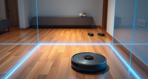

Modern robots achieve high mapping accuracy by combining advanced sensor calibration with detailed data resolution. Proper calibration guarantees sensors like lidar, cameras, and IMUs provide precise measurements, while higher resolution captures more environmental detail. This combination allows robots to navigate and understand complex environments reliably. If you want to discover how these factors work together to improve accuracy and what techniques are used, you’ll find valuable information ahead.
Key Takeaways
- Modern robots achieve high mapping accuracy through advanced sensor calibration and high-resolution data capture.
- Calibration ensures sensors provide reliable measurements, reducing errors in the generated maps.
- Higher data resolution allows detailed environmental representation, improving navigation and decision-making.
- Combining precise calibration with optimal resolution minimizes distortions and enhances overall mapping reliability.
- Ongoing calibration routines and technology improvements continually enhance the accuracy of robotic mapping systems.
Mapping precision is vital for guaranteeing accuracy in navigation, surveying, and geographic analysis. When you’re working with modern robots, whether they’re autonomous vehicles or surveying drones, their ability to produce precise maps depends heavily on how well their sensors are calibrated and how detailed their data resolution is. Sensor calibration is a critical step because it guarantees that all sensors, like lidar, cameras, and inertial measurement units, provide accurate readings. If these sensors aren’t properly calibrated, even the most advanced robots can produce distorted or unreliable maps. Regular calibration routines help correct for any drift or misalignment that might occur over time, maintaining the integrity of the data collected.
Proper sensor calibration and high data resolution are essential for accurate robotic mapping.
Data resolution also plays a significant role in mapping accuracy. Higher data resolution means the robot captures more detailed information about its surroundings, leading to more precise maps. For example, a lidar sensor with high resolution can detect smaller objects and subtle terrain features that lower-resolution sensors might miss. This level of detail is vital when mapping complex environments, like urban settings or dense forests, where small inaccuracies can lead to significant errors in navigation or analysis. Conversely, if the data resolution is too low, the resulting maps will lack the detail needed for precise decision-making, potentially leading to navigation errors or incomplete surveys.
You must pay close attention to how these factors interact. Proper sensor calibration guarantees that the data collected is accurate from the start, while high data resolution allows that accurate data to be detailed enough for precise mapping. Together, they form the backbone of reliable geospatial data. If either is neglected, the entire mapping process can suffer, resulting in maps that are less trustworthy and less useful. For instance, even a well-calibrated sensor can produce poor-quality data if set to an inadequate resolution, and vice versa.
In practice, maintaining high mapping precision involves ongoing calibration procedures and choosing the right sensor settings for your specific application. It’s also about understanding the trade-offs—higher resolution often means increased data processing requirements and storage needs, but it pays off by delivering more accurate and detailed maps. As technology advances, sensors are becoming more sophisticated, making it easier for you to achieve greater accuracy. However, the key remains in how well you calibrate those sensors and select appropriate data resolutions to guarantee your maps are as precise as possible, ultimately enabling better navigation, analysis, and decision-making. Additionally, sensor calibration ensures that the data captured remains trustworthy over time, especially when dealing with complex environments.

WayPonDEV FHL-LD19 360 Degree 2D Lidar Distance Sensor Kit, 10Hz Scan Rate and 12m Distance Lidar Scanner Module for Smart Obstacle/Robot/Maker Education Indoor/Outdoor
[High Accuracy] DTOF FHL-LD19 Kit, based on DTOF LD19, which has a sampling rate of 8000 times/s. In…
As an affiliate, we earn on qualifying purchases.
As an affiliate, we earn on qualifying purchases.
Frequently Asked Questions
How Do Robots Handle Mapping in Dynamic Environments?
When you ask how robots handle mapping in dynamic environments, you’re exploring their ability to adapt. Robots use sensor fusion to combine data from cameras, LIDAR, and other sensors, helping them understand environmental variability. They update their maps in real-time, allowing quick adjustments to moving objects and changing conditions. This continuous process guarantees accurate navigation, even amid constant environmental shifts, making robots effective in unpredictable settings.
What Factors Affect a Robot’S Mapping Accuracy?
You should know that several factors influence a robot’s mapping accuracy. Sensor calibration is essential—if sensors aren’t properly calibrated, data becomes unreliable. Environmental interference, like dust, reflective surfaces, or electromagnetic noise, can distort sensor readings too. Additionally, rapid movements or changes in lighting conditions can impact data quality. By maintaining calibration and minimizing interference, you can considerably improve the robot’s ability to create precise and reliable maps.
Can Robots Update Maps in Real-Time Effectively?
Your robots can update maps in real-time more effectively than you might imagine, even in complex environments. They rely on advanced sensor fusion, combining data from multiple sensors to create a seamless understanding of their surroundings. Obstacle detection helps them quickly identify changes, ensuring their maps stay current. With these innovations, your robots adapt swiftly, maintaining accurate, up-to-date maps that enable flawless navigation and decision-making every second.
How Do Different Sensors Impact Mapping Precision?
You should know that different sensors substantially impact mapping precision. Sensor fusion combines data from multiple sources like LiDAR, cameras, and ultrasonic sensors, improving accuracy. Noise filtering removes errors and irrelevant data, enhancing the map’s clarity. By integrating these techniques, you enable your robot to create more precise and reliable maps, even in challenging environments. This results in better navigation and decision-making capabilities for your robotic system.
What Are Common Challenges in Robot Mapping Technology?
You face challenges in robot mapping like sensor calibration issues, which can lead to inaccurate data, and difficulties in data fusion, causing inconsistencies in the map. Environmental factors such as lighting and obstacles also complicate mapping. Overcoming these hurdles requires precise calibration and effective algorithms that integrate data from multiple sensors. By addressing these challenges, you improve the accuracy and reliability of your robot’s mapping capabilities.

KEAcvise 6-Pack GY-521 MPU6050 Sensor Module – 6-Axis IMU with 16-bit ADC, 3-Axis Gyro/Accelerometer, I2C Interface for Drones/Robotics/Motion Control/STEM Labs/Industrial Automation
Product Name MPU-6050 MPU6050 6-Axis Accelerometer Gyro Sensor, which is a key component for motion sensing applications.
As an affiliate, we earn on qualifying purchases.
As an affiliate, we earn on qualifying purchases.
Conclusion
So, as you stand there, imagining a robot maneuvering with the precision of a knight wielding a laser sword, remember that technology keeps improving. Today’s robots are like modern cartographers with a GPS and a compass, charting unknown territories with surprising accuracy. While they’re not quite the oracle of Delphi, their mapping skills are impressive enough to make you feel like you’ve stepped into a science fiction novel — minus the flying cars, of course.

Lefant LiDAR Robot Vacuum and Mop, Smart Mapping and Obstacle Avoidance, Tangle-Free Pet Hair, 2.4G/5G WiFi App Control, Slim Design for Wider Coverage, Carpet Detection, M330 Pro
【dToF Navigation & Multi-Floor Mapping】With advanced dToF navigation, the Lefant M330 Pro lidar robot vacuum efficiently scans up…
As an affiliate, we earn on qualifying purchases.
As an affiliate, we earn on qualifying purchases.

HIWONDER Robot Car with ChatGPT Large AI Models, 3D Depth Camera Ackermann Chassis ROS2-HUMBLE Lidar SLAM Mapping Navigation Autonomous Driving, MentorPi A1 Advanced Kit Without Raspberry Pi
For Raspberry Pi 5 & ROS2 Robot Car. MentorPi A1 smart AI robot car is powered by Raspberry…
As an affiliate, we earn on qualifying purchases.
As an affiliate, we earn on qualifying purchases.